We've got 2 definitions for GEOREF »
What does GEOREF stand for?
What does GEOREF mean? This page is about the various possible meanings of the acronym, abbreviation, shorthand or slang term: GEOREF.
Filter by:
Sort by:PopularityAlphabeticallyCategory
What does GEOREF mean?
- GEOREF
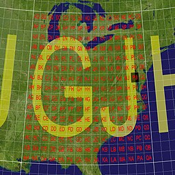
- The World Geographic Reference System (GEOREF) is a geocode, a grid-based method of specifying locations on the surface of the Earth. GEOREF is essentially based on the geographic system of latitude and longitude, but using a simpler and more flexible notation. GEOREF was used primarily in aeronautical charts for air navigation, particularly in military or inter-service applications, but it is rarely seen today. However, GEOREF can be used with any map or chart that has latitude and longitude printed on it.
Still can't find the acronym definition you were looking for? Use our Power Search technology to look for more unique definitions from across the web!
Citation
Use the citation options below to add these abbreviations to your bibliography.
Style:MLAChicagoAPA
"GEOREF." Abbreviations.com. STANDS4 LLC, 2024. Web. 19 Jul 2024. <https://www.abbreviations.com/GEOREF>.


Discuss these GEOREF abbreviations with the community:
Report Comment
We're doing our best to make sure our content is useful, accurate and safe.
If by any chance you spot an inappropriate comment while navigating through our website please use this form to let us know, and we'll take care of it shortly.
Attachment
You need to be logged in to favorite.
Log In